The Real World in Computational Space
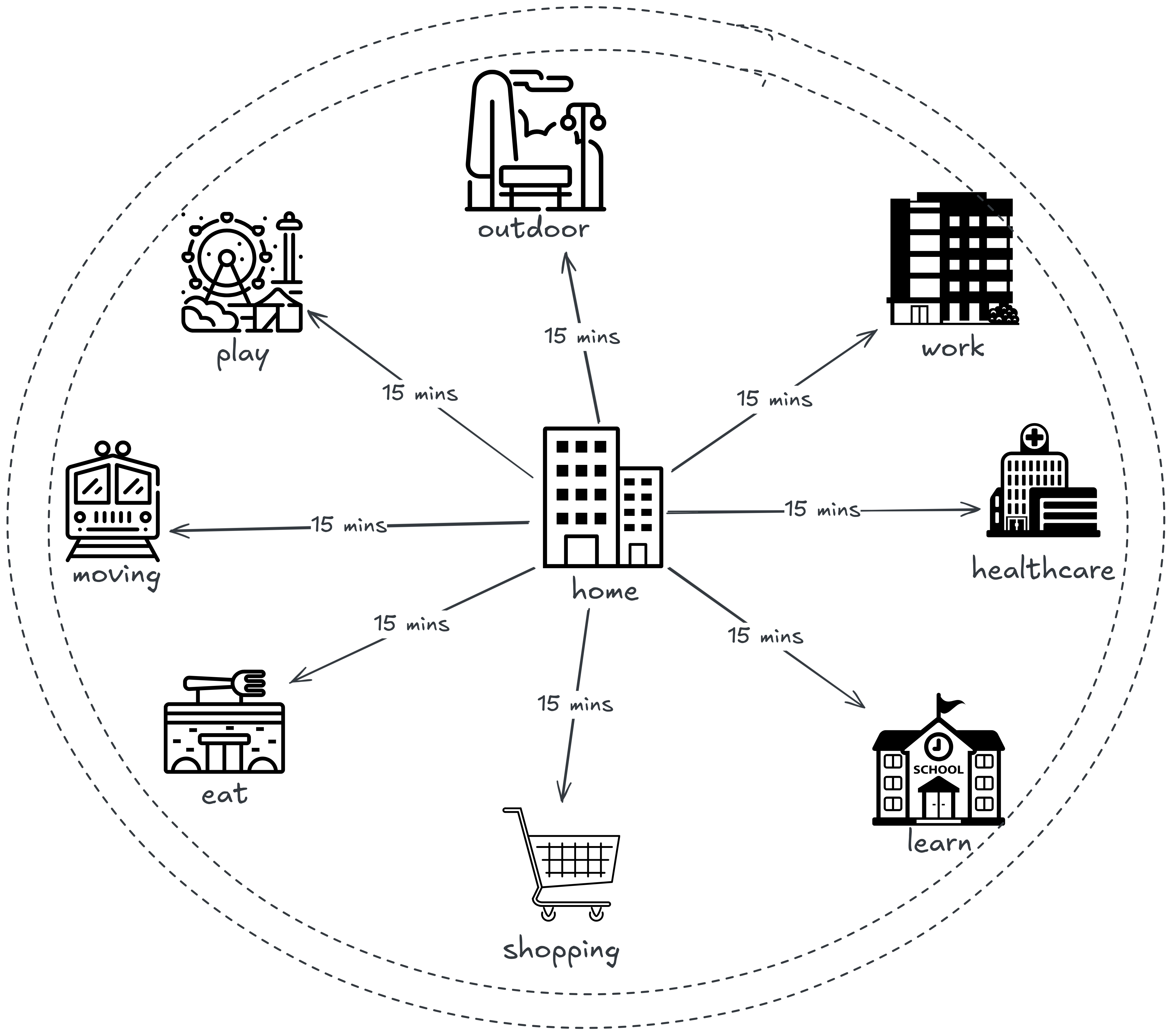
Can You Reach Everything in 15 Minutes?
a GIX application
What is the 15-Minute City?
-
Access daily needs within 15 minutes
Designing neighborhoods where essential services are reachable within a short walk or bike ride.
-
Work, school, parks, healthcare
Integrating jobs, education, green space, and medical services into connected, livable communities.
-
Walkable & bike-friendly neighborhoods
Prioritizing safe streets and active mobility to support healthier, low-carbon lifestyles.
How We Make It Happen
-

Map travel time accessibility
Use spatial analysis to measure how easily residents can reach essential services within a given time.
-

Analyze public transport networks
Model routes, connectivity, and efficiency to improve how people move across the city.
-

Identify underserved areas
Detect neighborhoods lacking access to key services to support more equitable urban planning.
Data-Driven Urban Mobility
Smart Card Data
Analyze tap-on/tap-off patterns to model travel behavior.
GPS & Mobility Tracking
Track commuting habits and route choices.
Traffic Flow Analysis
Identify bottlenecks and optimize movement.
Multimodal Integration
Combine all transport modes into a complete city picture.

GIX in Action
-
Optimize bus routes
GIX analyzes smart card and GPS data to model travel demand across time and space. This allows planners to redesign routes, reduce waiting times, and serve more people efficiently.
-
Plan cycling networks
Spatial analysis identifies safe, connected corridors by combining traffic, land use, and elevation data. GIX helps cities design bike networks that are practical, accessible, and widely used.
-
Reduce congestion
By modeling traffic flow and bottlenecks, GIX reveals where delays originate and how they propagate through the network. Decision-makers can simulate interventions before implementation, saving time and resources.
-
Improve sustainability
Geospatial intelligence quantifies emissions, travel behavior, and accessibility patterns. This enables data-driven policies that reduce carbon footprint while improving quality of life.
Shaping the Future of Cities
Lower Carbon Emissions
Geospatial intelligence models travel behavior, land use, and energy consumption across space and time. This enables cities to design transport systems and policies that measurably reduce carbon footprints.
Better Quality of Life
Spatial analytics reveals how access to services, green space, and mobility affects daily living. Data-driven planning improves accessibility, safety, and overall urban wellbeing.
More Inclusive Cities
GIX identifies underserved neighborhoods through accessibility and demographic analysis. This supports equitable distribution of infrastructure, services, and opportunities.
Data-Driven Urban Policy
Decision-makers can simulate policy scenarios before implementation using spatial models. This reduces uncertainty and ensures policies are grounded in evidence rather than assumptions.